Japan Pilot Weather
Central Japan Weather briefing
The Japan Weather Agency (JMA) provides several charts, forecasts and documents for the aeronautical operations. Navigation inside all the documents could be difficult when you don’t know all the expressions, words and abbreviations used. Aim of the page is to present the documents, not to recall the traditional abbreviations used inside METARs, TAFs…
You should be able to find the charts on this page: link: http://www.data.jma.go.jp/airinfo/index.html[jma website]
You can also consult: kishou website nihonkai
This page contains the basic weather information for a flight in central Japan.
Significant weather forecast (FBJP and FBTK)
General forecast

FBJP
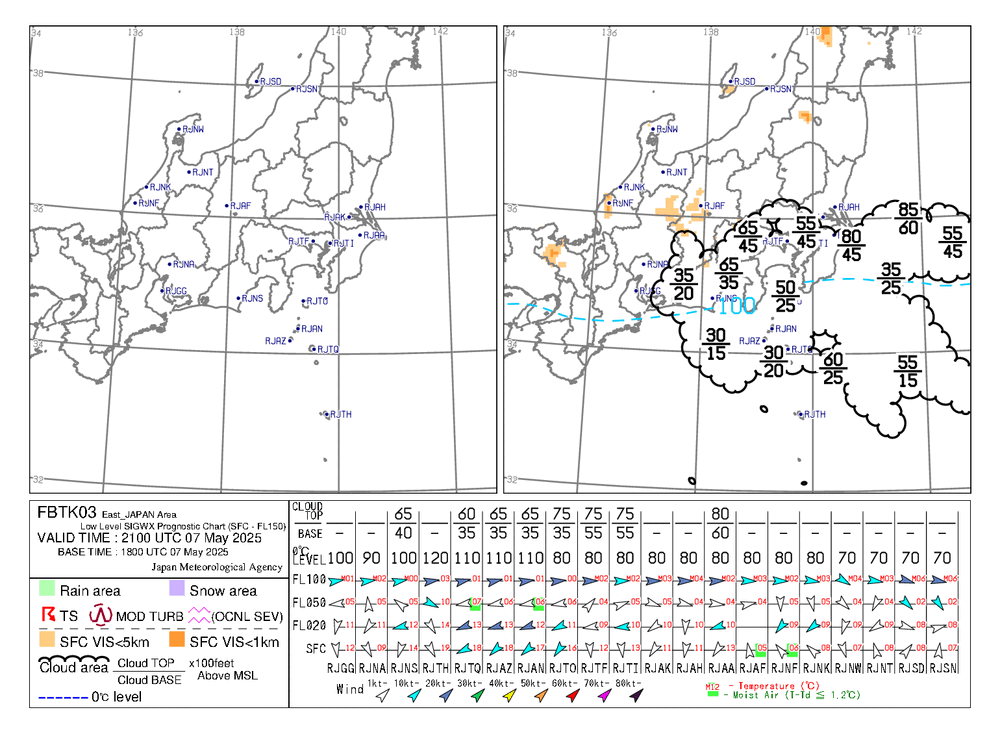
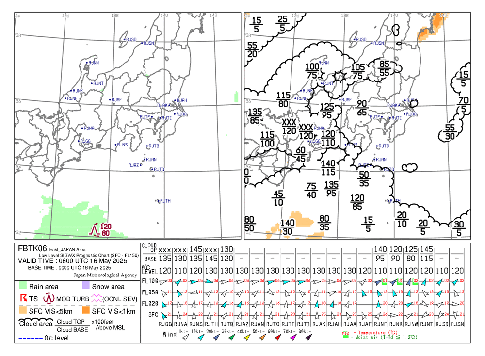
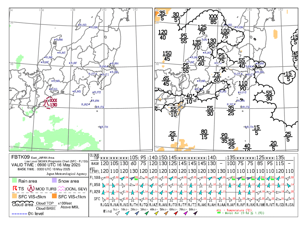
Low level forecast (up to FL150)
http://www.data.jma.go.jp/airinfo/data/awfo_low-level_sigwx.html#contents_area2

FBTK at 3h
| FBTK 6h | FBTK 9h |
|---|---|
 |  |
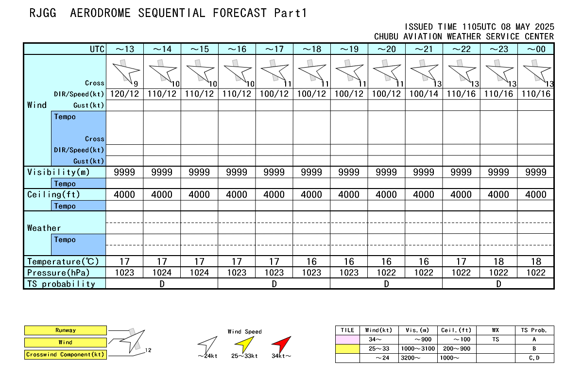
Airport Forecast (QMCD)

RJGG Airport forecast
Weather Surface Forecast (FSAS)
http://www.data.jma.go.jp/fcd/yoho/data/wxchart/quick/FSAS24_COLOR_ASIA.pdf http://www.jma.go.jp/jp/g3/images/24h/pdf/fsas24.pdf

FSAS24 Run 00Z

FSAS24 Run 12Z
| FSAS48 Run 00Z | FSAS48 Run 12Z |
|---|---|
 |  |
Wind and Temperature Forecast at 850 hPA-5000ft (FXJP85)
My advice: you should use the Hourly atmospheric analysis instead. You can find the FXJP85 runs here: 00z run: http://www.jma.go.jp/jp/metcht/pdf/kosou/fxjp854_00.pdf
12z run: http://www.jma.go.jp/jp/metcht/pdf/kosou/fxjp854_12.pdf
